| The Yonkers Wastewater Recovery facility (where our sewage goes) lost power and discharged sewage into the river on July 3. Westchester County passed on the New York State warning telling people not to use the river.Then heavy rains that weekend lead to potentially more storm and wastewater in the river. The county told people to stay out of the water until further notice. Hudson River towns went 10 days without use of the Hudson River before the county got a good reading at Philipse Manor Beach Club on July 13.The situation left many frustrated and looking for better data on whether the river is safe. Climate change is, unfortunately, making incidents like these and our recent harmful algae bloom (HAB) more of a problem. Heat waves, bigger storms and our antiquated sewer system (which carries fertilizer and sometimes sewage) all contribute to more harmful bacteria and algae in the Hudson. Sustainable Sleepy Hollow is working to get more reliable and usable water quality information to the public more quickly. This newsletter will soon have a special issue on water quality in the Hudson soon. 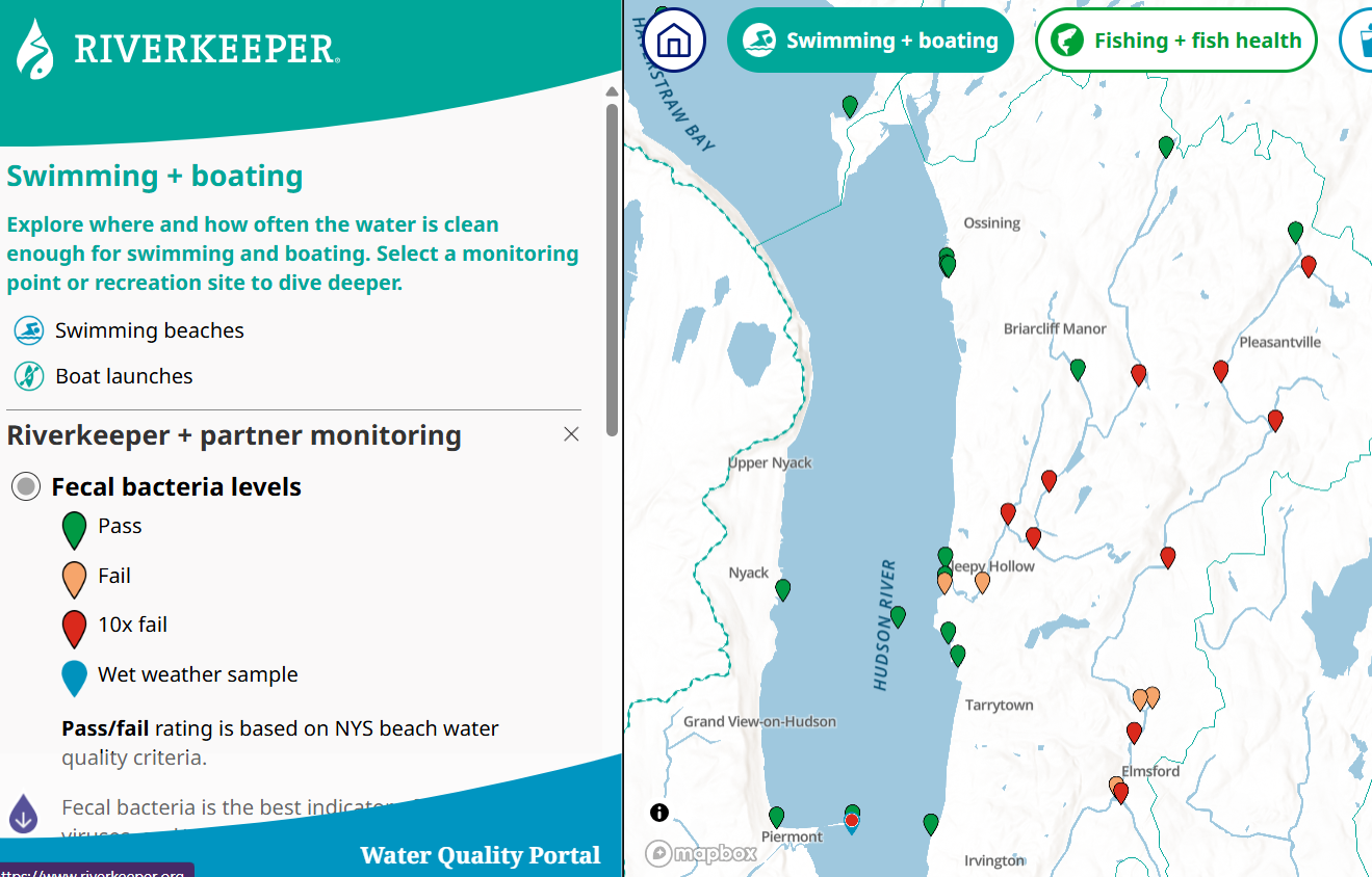 WAYS TO CHECK HUDSON RIVER WATER QUALITY Unfortunately there is no real-time information on Hudson River water quality that measures harmful bacteria and algae. Check Riverkeeper’s monthly testing of sites along the Hudson for fecal bacteria, chlorophyll and Phycocyanin (blue-green algae). Sign-up to receive sewage discharge alerts directly to your phone, email, or text via the NY-alert system. Once you created your account, add Sewage Discharge Notification to your list of alerts. The Minnesota Pollution Control Agency published a handy guide to 2 Simple No Cost Tests for Blue Green Algae. The only equipment you’ll need is a stick and a jar. Hudson River Environmental Conditions Observing System is real, live data online. Unfortunately, the nearest station is Piermont and it measures temperature, turbidity, acidity, conductance and oxygen levels. That data can offer clues about water health for scientists, but doesn’t offer a simple yes-or-no answer about whether you can let your kid in the water. Check the NYS HAB map. maps The map relies on alert governments and citizen scientists. REPORT SUSPICIOUS ALGAE or mail HABsInfo@dec.ny.gov Attend NY STATE Webinar: Know it, Avoid it, Report it: Harmful Algal Blooms in New York State Thursday, July 16, 10:00 – 11:00 a.m. | Online In 2025, the Hudson River experienced a harmful algal bloom (HAB), likely driven by regional drought, warm water, calm conditions, and nutrients. In this webinar, scientists with DEC and DOH will discuss New York State’s approach to addressing HABs including monitoring, research, mitigation, and reporting. Register for the HABs Webinar Attend the Cary Institute’s Webinar on Harmful Algae Blooms on August 5. The Department of Environmental Conversation released a report (2021-2025 Annual Hudson River Estuary Coordinator’s Report) on what they’ve done over the last five years for the Hudson River.Some highlights:Fisheries biologists have learned American Shad populations are below critical levels. River herring isn’t doing well, either. But Shortnose Sturgeon—listed as endangered in 1973—are doing great. In fact, with an estimated 72,000 individuals, the Hudson may be home to the largest population in the world.  Last year’s drought moved the salt front all the way up to Poughkeepsie. In an estuary, the salt front is the boundary where fresh water and salt water meet, and it is constantly moving with the cycle of the tides and the downstream flow of fresh water. Multispecies Telemetry Project Biologists tag American eels, Blueback Herring, Juvenile Atlantic Sturgeon, Shortnose Sturgeon and use acoustic telemetry to track them. The underwater receivers (fish detection equipment) are primarily hung on US Coast Guard buoys from the Harbor to the Federal Dam and when a tagged fish swims past the equipment, the receiver stores the tag number, date, and time (like EZ Pass for fishes). These data helps us understand how fishes move through the Hudson River and allow us to identify, protect, and restore important habitat. The DEC partnered with USGS to perform water quality monitoring in the Lower Hudson River estuary in 2023–2024. You can find some data here on the ARCGIS system. It’s not real-time usable data.Since 2021, DEC’s Hudson River Estuary Management Program awarded 111 grants, supported 51 research projects, and provided hands-on technical assistance to 196 municipalities and 10 counties in locations throughout the Hudson Valley. More than $16.9 million in EPF funding supported these projects, which included tree plantings, climate-adaptation plans, water quality monitoring, fish habitat restoration, river access improvements, natural resources inventories, and education programs. And what about the future of the River? To see what the DEC is planning for 2026-2030, check out the Hudson River Estuary Action Agenda 2026-2030 to learn about future actions and goals |


Leave a Reply